Maps offer new ways of seeing and experiencing the world. By showing the connections and relationships between things, they allow for a greater understanding of complex issues. Google Earth and Google Maps have increasingly become powerful tools used by social activists to create change.
- Watch: Trading Bows and Arrows for Laptops (Short Version)
- Download Google Earth
- Get A Grant For Google Earth Pro
- Watch A Google Earth Movie: Neighbors Against Irresponsible Logging (NAIL)
- See Google Earth Embedded Online: Appalachian Mountaintop Removal
- Full Tutorial Page: Google Earth Outreach: Beginner Tutorials
- Short Tutorial (Video Only): Google Maps: Create Personalized Maps
- "Eyes in the Sky and on Your Desktop" (2007)
- With Google Earth, satellite images become an activist's ally.
- "Tools, Thoughts, and Things one can Do with a little Time and Hardly any Resources" (2007)
Maps are nothing new, yet new things are happening to them — both in the traditional flat paper-based format and of course also in the context of social media and web 2.0.
Google Earth Outreach - Case Studies
Lots of non-profits are using Google Earth to tell their stories. You can read here about some specific groups' goals, challenges, and best practices, and the overall impact of visualizing their work in Google Earth.
San Francisco Mural Project
San Francisco State graduate and undergraduate students enrolled in the course "Ethnographic Research Methods" (ANTH 651), under the leadership of Prof. Mariana Ferreira, are conducting fieldwork in the SF Bay to produce a highly visible Health Equity mural in Fall 2010. Students in the class are learning basic ethnographic research tools from a community-based participatory perspective in order to better understand differences in health that are not only unnecessary and avoidable but in addition unfair and unjust. In particular, we are concerned with poor, underserved communities in the City who suffer the most from health disparities, and who have little or no access to health care. Ethnographic field projects, including the mapping of murals in the SF Bay, will yield information toward the final community mural project

California's Top Polluting Facilities
Recent media investigations (CBS 5 2008) and environmental reports (Still Toxic After All These Years 2007) in California, as well as scientific studies in the broader US, show growing levels of pollution released into the air and water - in particular potential carcinogenic substances (sulphur dioxide, hydrocarbons, and oxides of nitrogen) - affecting mostly the health of low-income minorities. The evidence so far links cancer incidence (in particular breast cancer) with residential exposure to air and water emissions from petroleum and chemical plants. This prompted Right To Know to look more closely at the exact locations of these major polluting facilities and the surrounding communities they affect.
Klamath River Clean-Up (In Progress)
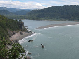
This map shows what American Indian youth in Northern California are doing today to save the Klamath River. Students at the Klamath River Early College of the Redwoods (KRECR), on the Yurok Indian Reservation, have joined community efforts to bring salmon back to the people.
